There have been plenty of photos from ground level, but NASA today released the first satellite images of the Hungary toxic sludge flood.
NASA describes the photos as follows:
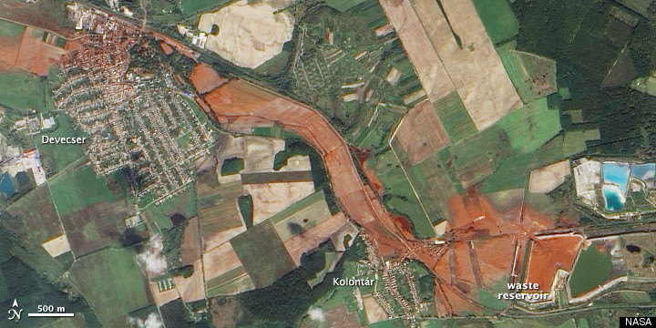
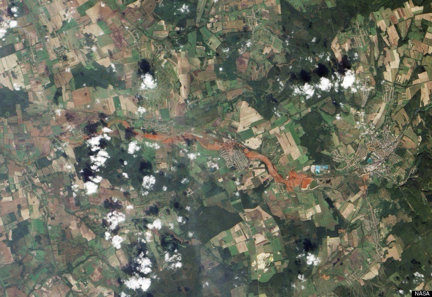
On October 9, 2010, the Advanced Land Imager (ALI) on NASA's Earth Observing-1 (EO-1) satellite captured this natural-color image of the area. The top image shows a close-up of the alumina plant and closest villages. The bottom image shows the wider region.
The incident has been called "an ecological disaster" and it has forced Hungary to declare a state of emergency.
View the images from NASA's Earth Observatory below:
Advertisement